Multispectral Imagery. Accurate. Immediate. Anywhere.
A Case for Multispectral Imagery
Data Collected on 10 June, 2018
- Peanut Stand Survey #1 -180 acres
- Canopy appeared unaffected
- Wet conditions in early 2018
- Hot & Dry thru May/June
- 38 minutes Time-of-Flight (TOF)
- Processed imagery on the spot (15 mins)
- Widespread Stress revealed in the imagery
- White mold had established underground


Data re-collected on 21 June, 2018
- Peanut Stand Survey #2 -180 acres
- Canopy appeared unaffected
- 38 minutes TOF
- Processed imagery on the spot (15 mins)
- Peanut stand condition after application of Elatus
- Early intervention prevented a significant loss
Imagine seeing crop conditions before you even leave the house.
Georgia farmers and agronomists who use satellite crop health data in their Precision Ag programs now have a source for data delivered directly to their IOS and Android mobile device which is 480X more detailed than satellite imagery. Multispectral Imagery reveals crop performance by detecting chlorophyll content and the effects of pests, pathogens, irrigation issues, weeds, and other information needed to evaluate the health of a crop.
What kind of information can Georgia GEO drone imagery provide?
- Emergence Analysis
- Population (stand counts)
- Chlorophyll and Nutrient content
- Plant Height measurements (w/in ½” of each other throughout the field)
- Weed pressure (row crops and field crops)
- Stress from Pathogens/Pests/Irrigation issues
- Yield Estimates
- Severe Storm Damage Assessment for claims
- Data needed to formulate Variable-Rate Prescriptions
Georgia GEO has the tools and analysis to enable the grower to track what is happening in the fields or orchards. Farmers spend their lives ensuring they have the best crop in a bid to sustain an income for the family and products for the world. Through the years, they've ensured they use up-to-date technology to realize the best yield for their efforts.
Georgia GEO can provide this Data and Analysis. Immediately. On the edge of the field. Providing the grower with instant, actionable data.
"Old" new methods
Earth-observing satellite imagery is available and has been used, but due to the satellite’s distance from Earth, the resolution required to see EXACTLY what is going in YOUR field is limited. Its orbit may not put the satellite over the field at the optimum time and even if it does, the weather must be perfect. Multispectral packages in manned aircraft or helicopters can be used, but those systems can be cost-prohibitive and still not match Georgia GEO's detail.
Superior Technology available immediately and on-demand
SlantRange sensors can be put to use at the perfect times of day and be brought up close and  personal via drones flying just a couple of hundred feet high, rather than a couple of hundred miles high. The grower can see what is going on out in the fields, at significantly less cost, and have detailed Actionable Data available. Right now...today.
Time is critical, and data can be more perishable than an untreated stand.
Rifle vs. Shotgun
Save time, money, and expensive agricultural chemicals treating only the areas identified by the multispectral imagery. Multispectral geotagged data can be integrated into Precision-Ag variable rate applications.
How Multispectral Sensing works: an in-depth discussion
Receptors in the human eye can sense three basic colors: Red, Green, and Blue. Our brain combines these basic colors of the spectrum to allow us to see all other colors.
Healthy plants ABSORB the red and blue spectra of light for photosynthesis. Conversely, healthy plants REFLECT most light in the green spectrum and light in the near-infra-red (NIR) spectrum. This is why most healthy plants appear green (chlorophyll pigment is also green and that is a contributor) but still, our human eyes cannot see NIR.
If a plant is unhealthy for whatever reason: drought, pathogens, pests, even overwatering, the reflected light from the leaves begins to change, even if it cannot be seen by the grower. As the plant become more stressed, the spongy layer of the leaves, which, due to internal cellular structures, begins to reflect NIR light differently. Sick plants are unable to absorb as much red and blue light and so begin to appear different. In the same way that oil on water reflects different wavelengths of light (colors) due to minute thickness variations in the oil layer, so does NIR light react to healthy and unhealthy thicknesses of the spongy layer of leaves.
This is called a Difference Vegetation Index; we’ll get back to that.
By the time the grower can detect these changes of color in the cultivar, damage is usually far progressed.
This is where Georgia GEO and SlantRange come into the mix.
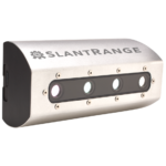
SlantRange detects red, green, blue, and NIR (near infra-red, aka Red Edge) light. As the drone flies over the field (many times closer than a satellite), it takes individual pictures in those specific wavelengths (colors), even the NIR colors that human eyes cannot see.
Georgia GEO's powerful on-site computer, with SlantRange exclusive software, combines those individual pictures, performs imagery analysis and calculates the reflection attributes (mathematical values) of the foliage in the field canopy within minutes, showing the grower where these color proportions are out of the norm(s), indicating stressed vegetation.
No Wi-Fi or Internet connection is needed. No uploading data to the “cloud.” With other cloud-based systems, analysis could take hours, possibly days, (there is a LOT of data collected) requiring the data and images to be uploaded to a far-off computer system, processed, and returned to the grower.
Actionable. Accurate. Data. In minutes.
NDVI
 (NDVI) Normalized Difference Vegetative Index is one of the most useful vegetation Indexes in Precision Agriculture. “Normalized” refers to the fact that differing amounts of sunlight, even something as ordinary as cloud shadows on a field during an aerial survey, can dramatically affect the results of the multispectral survey.
SlantRange’s multispectral imagery is constantly calibrated during flight to ensure variations in sunlight are corrected. Very few other multispectral imagery systems offer this capabili

