Georgia GEO provides information to those who work to save us, and those who work to restore us.
Georgia GEO is one of the foremost providers of the types of imagery used by
Emergency Management, Disaster Response, Utilities Emergency Response Teams,
and Insurance Damage Assessors.
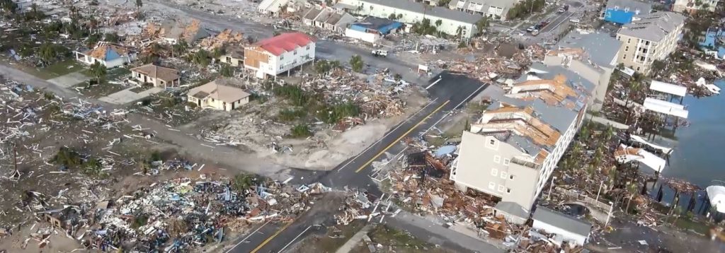
Emergency Management
Preserving Public Safety, and the safety of our First Responders, is paramount. Georgia GEO can deploy our drones for up to 45 minutes per flight, get a birds-eye view of the situation, and stream that video/information instantly to the authorities. Emergency Management and Disaster Response Teams of all types can plan their activities and prioritize their missions. Time is saved and valuable resources are focused where they are needed most. Disasters such as major flooding or severe weather causes destruction extending across many square miles. Georgia GEO can cover those miles…..in minutes.
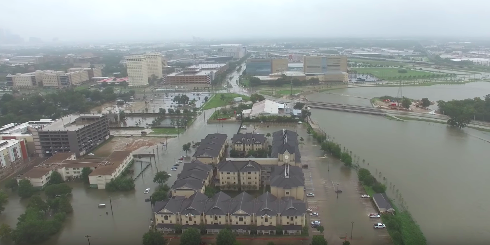
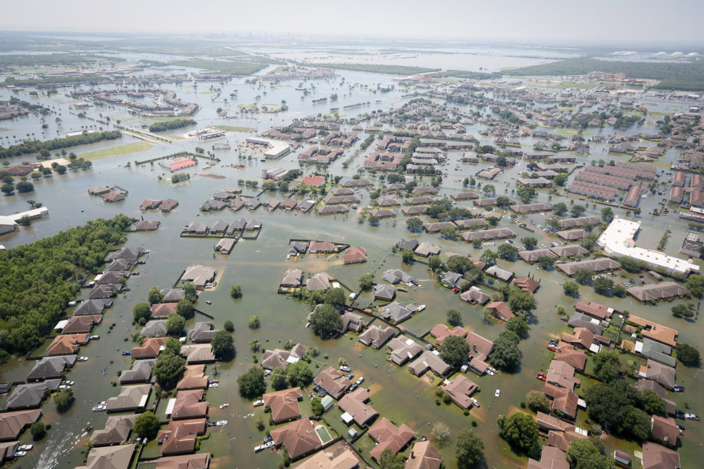
Insurance Claims Management
The public needs a return to normal life as quickly as possible. Georgia GEO can help when homes and property are damaged or destroyed. Preliminary damage estimates through airborne imagery allows Insurance Assessors to get to work. Drones can take photos in difficult-to-access areas in the midst of a crisis, rather than afterwards. Insurers can process claims for their Policyholders more quickly. People are happiest with insurers when claims are processed and paid in a fraction of the usual time. Customers can rest easy knowing help is on the way. Top-quality insurance companies respond promptly to Customers’ needs and enjoy a credibility windfall from the resulting goodwill toward the insurer, not to mention further cost savings to the customer through improved efficiency.
Roof Damage
A roof over your family’s head is one of the most important things in life. Georgia GEO can perform roof inspections and send roof damage imagery to Insurance Assessors. A 20-minute damage inspection by a small UAS can capture hundreds of images of property in distress. Imagery data can then be used to produce 3D models or elevations with 99.5% dimensional accuracy, enabling rapid resolution of estimates and payment for storm, hail, or old-age (the roof’s) damage.
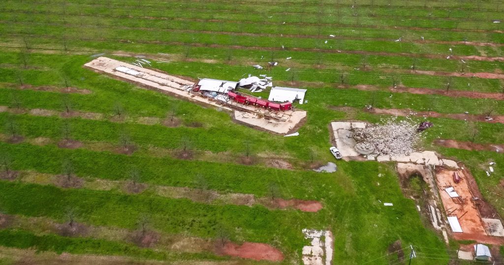
Crop Insurance
Georgia GEO’s specialized multispectral sensors can provide imagery and pinpoint exactly where acreage has is storm-lodged or damaged. We can show both the grower and crop insurer the extent of damage, providing accurate information for claims resolution. A drone can examine acreage in a fraction of the time as an adjuster on foot, assisting both parties in the quick settlement of a claim. This technology can also provide farmers with comprehensive information early in the season when determining how much crop insurance coverage they need. This means more insurance plans can be based on enterprise-level (precisely-defined) data rather than county numbers.
Hazardous Area Surveys
Georgia GEO’s small UAS can also go places that are too risky for humans: fire-damaged buildings, places where chemical toxicity is suspected, damaged infrastructure facilities, or other areas that have been subject to accidental or natural disasters can be accessed by the small UAS.
Find out what Georgia GEO can do for you. Contact Us today for more information and updates on our services.![]()